Essex · Orleans · Caledonia
Hiking the Northeast Kingdom
Discover woodland walks, lakeside paths and mountain viewpoints throughout Vermont's Northeast Kingdom. Explore hikes across Essex, Orleans and Caledonia counties, from easy outings to challenging climbs.
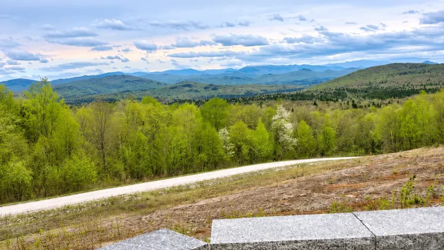
Explore all three NEK counties
Hiking trail directory
Search 18 destinations, with six in each county. Filter by town, terrain and published outing distance. Entire networks and one-way trails stay clearly labeled.
Sources reviewed October 29, 2026. Each guide identifies its map, distance scope and remaining checks; no trail opening or current parking availability is certified.
Plan the drive
Enter a starting location to use for road directions. If left blank, choose your start in Google Maps. The town filter only changes the destinations shown.
Choose a guide for directions or a clearly labeled area search. This starting point affects road travel only; trail distances and snowmobile routes remain separate.
Suggest a Trail / Report an Update
18 destinations · current conditions unverified
Illustration placeholder Brighton / Island Pond · Essex County
Bluff Mountain Community Trail
A woodland climb above Island Pond, with a steep rocky lookout section and broad views. Plan for ledges and metal handholds.
- Published distance
- 3.6 miles · published outing
- Hiking terrain
- Moderate
Steep ledges and metal handholds require care, especially when wet or icy. Confirm the selected outing, small-lot access and current steward notices.
Trail details, arrival & sources for Bluff Mountain Community TrailIllustration placeholder Brighton / Island Pond · Essex County
Brighton State Park · Boreal Forest Trail
A short loop behind the nature center through boreal woodland. Choose this for a brief walk; it is not the whole park network or a full-day hike.
- Published distance
- 0.3 miles · loop
- Hiking terrain
- Easy core walk
Confirm park entry, any gate approach and legal parking. This short walk is not a winter-access or current-opening confirmation.
Trail details, arrival & sources for Brighton State Park · Boreal Forest TrailIllustration placeholder Norton · Essex County
Averill Mountain
A compact climb through mixed forest to a rock viewpoint, with a private-land approach. Confirm owner signs and a safe, legal arrival; the short distance still includes uphill effort.
- Published distance
- 1.2 miles · round trip
- Hiking terrain
- Moderate
Private-land approach and roadside arrival: confirm permission, legal parking and safe sight lines before traveling. Do not assume winter access.
Trail details, arrival & sources for Averill MountainIllustration placeholder Greensboro · Orleans County
Barr Hill Natural Area
A short preserve loop through woodland and meadow, with open landscape views. A useful option for a brief nature walk.
- Published distance
- 0.8 miles · loop
- Hiking terrain
- Easy
Respect the mud-season vehicle closure and confirm usable parking. Keep to marked preserve trails; neighboring ski paths do not carry the same permission.
Trail details, arrival & sources for Barr Hill Natural AreaIllustration placeholder Newport City · Orleans County
Bluffside Farm
A working-farm walk with fields, woods and lakeshore scenery. Use designated recreation paths and give farm operations space.
- Published distance
- 1 mile · one way
- Hiking terrain
- Rating not established
Dawn-to-dusk use only. Stay out of hayfields and buildings; use designated lots and respect farm machinery and current signs.
Trail details, arrival & sources for Bluffside FarmIllustration placeholder Norton · Essex County
Brousseau Mountain
A short forest climb to bedrock and a cliff lookout. The published nesting rule prohibits hiking before August 1; confirm current steward notices.
- Published distance
- 0.7 miles · one way
- Hiking terrain
- Easy–moderate
Published nesting restriction: no hiking before August 1. Confirm current closure notices and permitted arrival; reaching that date does not establish an opening.
Trail details, arrival & sources for Brousseau MountainIllustration placeholder Burke / East Burke · Caledonia County
Burke Mountain Hiking Trails
Marked woodland routes climb toward mountain viewpoints. Select a walking route rather than assuming ski slopes, mountain-bike trails or a toll road are interchangeable.
- Published distance
- 3.7 miles · entire network
- Hiking terrain
- Moderate
Confirm the current hiking entrance, visitor parking and resort notices. Do not enter bike-only trails, active operations areas or closed roads as shortcuts.
Trail details, arrival & sources for Burke Mountain Hiking TrailsIllustration placeholder Peacham · Caledonia County
Devil’s Hill
A blue-blazed woodland climb to a western viewpoint, with branching paths that can make a return loop when the marked routes are available.
- Published distance
- 1.4 miles · entire network
- Hiking terrain
- Moderate
Use the published kiosk arrival, confirm the road and do not seek parking beyond the gate. Choose the marked return route before setting out.
Trail details, arrival & sources for Devil’s HillIllustration placeholder St. Johnsbury · Caledonia County
Dog Mountain
Privately owned grounds welcoming people and dogs, with woodland paths, open scenery and a separate gallery and chapel. Expect off-leash dogs.
- Published distance
- 3 miles · entire network
- Hiking terrain
- Rating not established
Expect off-leash dogs and keep children supervised. Confirm visitor parking, events and current rules; ponds are not a recommended swimming or ice-crossing route.
Trail details, arrival & sources for Dog MountainIllustration placeholder Hardwick · Caledonia County
Hardwick Trails
Volunteer-maintained woodland trails with documented summer hiking. Pick a manageable marked route from the official map.
- Published distance
- 10 miles · entire network
- Hiking terrain
- Easy
Confirm designated school-lot visitor parking and current trail notices. Share routes considerately; no nearby snowmobile or rail-trail connection is assumed for this hike.
Trail details, arrival & sources for Hardwick TrailsIllustration placeholder Ferdinand · Essex County
Moose Bog Trail
A boreal-forest walk to a bog viewing platform. Move quietly and enjoy wildlife from the designated trail and boardwalk.
- Published distance
- 1 mile · round trip
- Hiking terrain
- Easy
Dogs must be leashed to protect ground-nesting birds. Confirm the South America Pond Road entrance and usable parking; no winter maintenance is promised.
Trail details, arrival & sources for Moose Bog TrailIllustration placeholder Westmore · Orleans County
Mount Hor · VT-5A approach
A longer published hike from the lower VT-5A arrival to Mount Hor, with forest and lake views. The road approach is part of this plan.
- Published distance
- 5.3 miles · published outing
- Hiking terrain
- Moderate
Use the lower VT-5A arrival for this published outing. Confirm road/trail notices and legal parking; do not route onto winter-closed CCC Road.
Trail details, arrival & sources for Mount Hor · VT-5A approachIllustration placeholder Westmore · Orleans County
Mount Pisgah
Choose a marked approach to forested summits and Lake Willoughby viewpoints. The network contains several routes, not one short family loop.
- Published distance
- 5.9 miles · entire network
- Hiking terrain
- Moderate–advanced
Exposed cliffs and steep terrain. Choose a specific approach, confirm current access and use designated parking; no loop, shuttle or winter route is assumed.
Trail details, arrival & sources for Mount PisgahIllustration placeholder Charleston / East Charleston · Orleans County
NorthWoods · All Persons Trail
A rolling woodland loop around the NorthWoods campus with a brook crossing and boardwalk. The operator publishes detailed grades and surface specifications.
- Published distance
- 0.88 miles · loop
- Hiking terrain
- Grades published · no rating
Review the published grades, bridge and boardwalk details before visiting. Confirm designated visitor parking and current campus/event restrictions.
Trail details, arrival & sources for NorthWoods · All Persons TrailIllustration placeholder Brunswick · Essex County
Nulhegan River Trail
A short refuge walk from the visitor contact station down to the Nulhegan River and back uphill through the forest.
- Published distance
- 1 mile · loop
- Hiking terrain
- Easy
Stay on land beside the river. Confirm current notices, parking and visitor-station facilities; a published office schedule is not a current guarantee.
Trail details, arrival & sources for Nulhegan River TrailIllustration placeholder Westmore · Orleans County
Sentinel Rock State Park
Short paths through former homestead fields and woodland, with a glacial boulder and broad views over Westmore.
- Published distance
- 1.6 miles · entire network
- Hiking terrain
- Easy
Published lots are unplowed in winter. Confirm the seasonal arrival; boardwalks, slopes and stream crossings require care.
Trail details, arrival & sources for Sentinel Rock State ParkIllustration placeholder St. Johnsbury · Caledonia County
St. Johnsbury Town Forest
Town woodland with riverside walks and steeper hillside paths. Choose a short marked route or connect trails using the published map.
- Published distance
- 2.9 miles · entire network
- Hiking terrain
- Easy–moderate
Confirm road and kiosk-lot access. Stay on land beside the river and use marked paths; no swimming or ice crossing is recommended.
Trail details, arrival & sources for St. Johnsbury Town ForestIllustration placeholder Sutton · Caledonia County
Wheeler Mountain
A marked forest climb to open bedrock viewpoints. The trail lies in Sutton even though common approaches are through the Willoughby / Barton area.
- Published distance
- 2.1 miles · entire network
- Hiking terrain
- Moderate
Private-land sections, a road crossing and exposed rock require care. Confirm marked routing and usable lot access; no roadside overflow permission is implied.
Trail details, arrival & sources for Wheeler Mountain
Before you head out
- Check manager notices, legal parking, weather and road access. Published use does not confirm a trail open today.
- Respect mud-season, wildlife, logging and private-property restrictions. If a lot is full, choose another destination; a directions link does not grant parking permission.
- Carry a map, layers, water, food, a headlamp and suitable footwear. Leave a route and return plan with someone. Cell service can fail.
- Keep back from cliff edges and stay on land beside water. Snow and ice change difficulty; these hiking guides do not certify winter access.
- Protect wildlife and vegetation, follow posted pet rules, and wear visible clothing where hunting is permitted. Keep to marked paths and pack out waste.